use cases
Navigation for every venue.

From hospital corridors to underground rail platforms - Waymap navigates anywhere your visitors need to go. Connecting your venue to your city, with city-wide routing.

Rail & Transport
Indoor navigation that keeps every passenger moving — with or without signal.

Transit networks carry millions of passengers daily — but underground, GPS fails and independent navigation breaks down. Waymap works without signal or fixed infrastructure, guiding every passenger from street level to platform with precise, turn-by-turn directions.

Navigate underground and indoors without GPS or signal
No beacons, no Wi-Fi, no infrastructure required
Reduces wayfinding demand on station staff
Seamless outdoor-to-indoor-to-underground journey continuity
Step-free routing for all passengers who need it
Audio guidance for people who are blind or visually impaired
Multiple languages to support tourists
The Challenge for Transport
Transit networks carry billions of journeys every year. Yet for passengers with visual impairments, cognitive disabilities, or unfamiliarity with a network, navigating underground and interchange environments remains a largely unsolved problem. Traditional indoor navigation solutions require costly fixed infrastructure — Bluetooth beacons, Wi-Fi positioning hardware, ongoing hardware maintenance. They're expensive to install and need complete reinstallation after any station renovation. Waymap requires none of it.
1 in 4

Adults globally live with a disability

WHO, World Health Organisation, 2023
38%

fewer trips are taken by disabled people in the UK than non-disabled people

Motability Foundation, Transport Accessibility Gap, 2022
Case Studies
Our Customer Stories

We're proud to work with some of the world's most complex transit networks, delivering accessible navigation at scale across North America and Southeast Asia.

Washington D.C., Maryland & Virginia, USA
WMATA – Washington Metropolitan Area Transit Authority
Step-by-step navigation across all 98 stations of the Washington Metro

The world's most extensive integrated intermodal wayfinding deployment — all 98 WMATA Metro stations across the DC, Maryland, and Virginia tri-state area, covering 27 million square feet and serving approximately 250 million passengers annually.

"We are thankful for their commitment to wayfinding and making the system accessible to all."

Sarah Meyer, Chief Customer Experience Officer, WMATA
Singapore
SBS Transit – Singapore
Infrastructure-free navigation across three MRT and LRT stations in Singapore

Waymap was deployed by SBS Transit across three stations — Tampines MRT, Punggol MRT-LRT, and Sam Kee LRT — covering approximately 1.2 million sq ft in total. The deployment created a world-first interconnected navigation cluster linking transit stations to the surrounding urban environment, with testing confirming strong navigation performance across all sites.

Birmingham, UK
WMCA – Birmingham New Street & University Station
Sensor-fusion navigation across Birmingham's busiest rail stations

Waymap was deployed by the WMCA at Birmingham New Street (approximately 730,000 sq ft, 25 platforms) and University Station in October 2024. The deployment was featured in the Sunday Times. Testing demonstrated significantly higher location accuracy than GPS-based alternatives in a challenging underground environment.

Press
Find Your Way with CapMetro: Introducing Accessible Wayfinding Technology

"We believe using public transit should be safe and easy for everyone." — CapMetro

Read the full article
Waymap backed by UK Government's Innovation Agency (Innovate UK)

"This award recognises our breakthrough technology and the revolutionary impact it will have on accessibility and inclusion." — Waymap

Read the full article
Children's hospital in Scotland leads the way on adding navigation tech for patients, staff

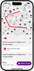
"It already is designed with accessibility at its very heart. It's not tacked on later." — Dr Olivia Swann, Paediatric Infectious Diseases Consultant, NHS Lothian

Read the full article
Visit the Newsroom →
Don't see your venue type?
Waymap navigates any indoor environment. Museums, conference centres, hotels – if people move through it, we can map it.
Talk to Our Team